
Easy Altitude
Geospatial utility tool
FlutterDart
Easy Altitude
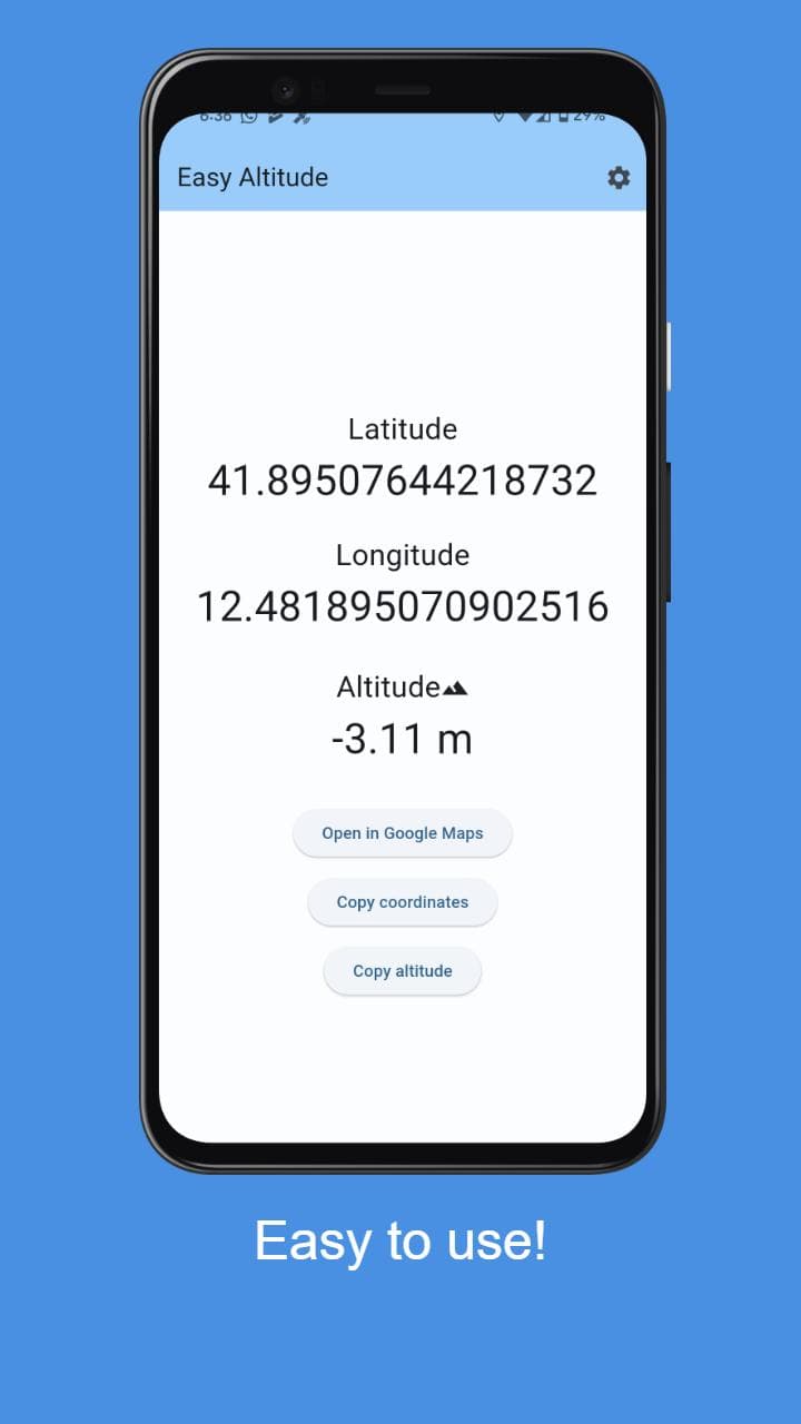
Easy Altitude is a functional Android utility built to provide users with immediate access to their geographic coordinates, elevation, and orientation. The app focuses on a minimal and efficient user interface, designed for clarity in outdoor environments where quick data retrieval is essential.
Core Functionality & Sensors
The app leverages the device's hardware sensors to provide accurate real-time data.
- Altitude Tracking: Utilizes GPS and barometric data (where available) to calculate the user's current elevation above sea level.
- Geospatial Coordinates: Displays precise Latitude and Longitude for exact location identification.
- Dynamic Compass: Implements an interactive compass that responds to the device's orientation to show the facing direction.
Design & Asset Integration
As with many of my projects, I handled the entire design lifecycle.
- Vector Design: I used Adobe Illustrator to create clean, scalable assets and icons, ensuring the UI remains sharp.
- UI Clarity: The interface is built for high readability, prioritizing the most critical data points for the user.